When Location Becomes Part of the Product
Imagine opening a delivery application and seeing restaurants available around you.
You select one, enter your delivery address, and the application immediately calculates the distance, estimates the delivery time, and shows the driver route on a map.
The experience feels simple.
But behind that simple interaction, the application may be working with coordinates, addresses, maps, routing APIs, distance calculations, location permissions, and several business rules.
Now imagine a property platform that helps users find homes within 10 miles of a selected location. Or a service marketplace that shows nearby professionals. Or a logistics application that calculates which driver is closest to a delivery.
All of these experiences depend on one common capability: understanding location and using it to make the application more useful.
Geolocation is therefore much more than putting a map on a webpage.
When implemented correctly, it can become part of the core product experience, helping businesses connect users, services, products, and real-world locations.
A Map Is Only the Beginning
When businesses think about geolocation, the first idea is often a map.
A map can certainly be useful, but most location-based applications need much more than displaying streets and markers.
A food delivery platform may need to identify nearby restaurants and calculate delivery distance. A field-service platform may need to assign technicians based on their location. A travel platform may need to calculate the distance between hotels, airports, attractions, and customer-selected destinations.
The application therefore needs to understand location in different forms.
An address may need to become latitude and longitude. Coordinates may need to be converted back into a readable address. Two locations may need to be compared by distance. A route may need to be calculated based on driving, walking, or another travel mode.
Google Maps Platform, for example, provides APIs for geocoding, places, routes, and other location-related functionality. Its Routes API can calculate routes between locations and return information such as distance and duration.
This means the real challenge is not simply adding a map. It is designing how location data will support the application’s business logic.
Turning Addresses Into Useful Location Data
Consider a service marketplace where a customer enters:
“123 Main Street, New York.”
The application needs to understand where that address actually is.
This is where geocoding becomes important. Geocoding converts an address into geographic coordinates that software can work with. Once the application has latitude and longitude, those coordinates can be used for distance calculations, proximity searches, mapping, and routing.
The opposite process is also useful.
A user may share their current coordinates, but the application needs to show a readable location such as a street, city, or area. This process is commonly known as reverse geocoding.
The quality of this data matters because inaccurate or ambiguous addresses can lead to incorrect routes and poor search results. Google’s current Routes documentation, for example, recommends using Place IDs where possible because they can provide more explicit location references than ambiguous address strings or raw coordinates.
For Laravel applications, this location logic can be integrated into the backend and connected with existing users, orders, service providers, properties, bookings, or other business entities.

Distance Calculation Changes How Applications Make Decisions
Knowing where something is located is useful.
Knowing how far it is can make that information actionable.
Imagine a customer searching for a home cleaning service. Ten providers may operate in the same city, but the application does not necessarily need to show all ten equally. It can calculate distance and prioritize providers who are within the customer’s preferred service area.
The same principle can be used in delivery, transportation, healthcare, field services, real estate, travel, and many other industries.
Distance can also become part of business rules.
An application might offer free delivery within a certain radius and charge an additional fee beyond it. A service provider may only accept bookings within 20 miles. A logistics platform may assign a delivery request to the closest available driver.
There is also an important distinction between straight-line distance and travel distance.
Two locations may be geographically close but separated by highways, rivers, restricted roads, or other barriers. For real-world services, the actual route and estimated travel time may therefore be more useful than simple geographic distance.
Google’s Route Matrix functionality is designed to calculate distance and duration across multiple origin and destination combinations, which can support use cases such as dispatch and logistics planning.
Location-Based Services Need More Than APIs
Connecting an application to a maps or routing provider is only one part of the implementation.
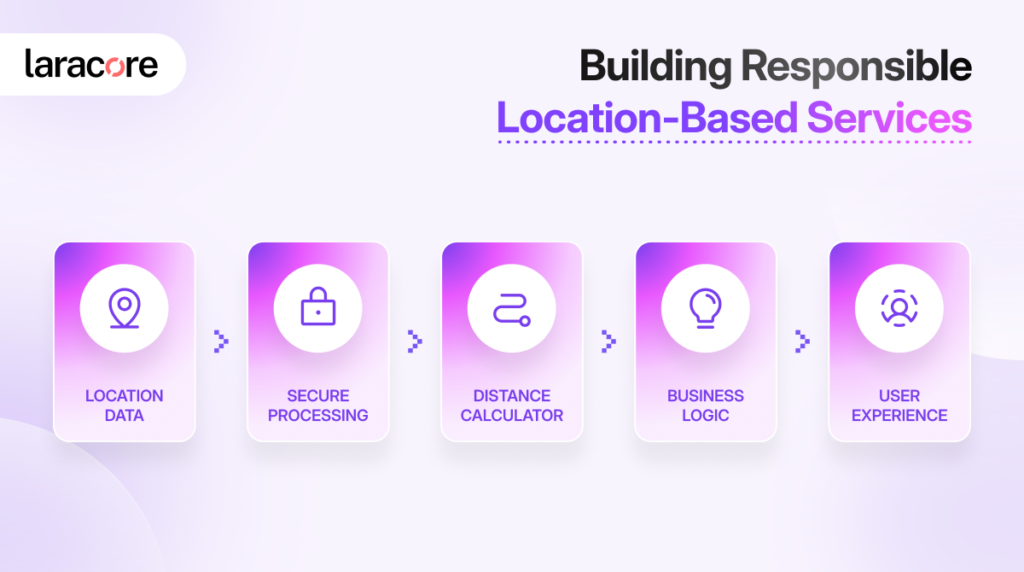
The application also needs to decide how location data should be stored, when it should be requested, how frequently it should be updated, and how much of that information is actually necessary.
For example, a delivery application may need frequent location updates while an order is active. A property platform may only need a property’s coordinates once. A local service directory may need location-based search without continuously tracking the user’s movement.
These are very different requirements.
A good Laravel Development Services approach considers the business purpose before deciding how location should be collected and processed. This can help reduce unnecessary API requests, improve performance, control infrastructure costs, and create a clearer user experience.
Caching can also become important. Repeatedly requesting the same geolocation information from an external provider can increase latency and cost. Location data that does not change frequently may be suitable for controlled caching, depending on the provider’s terms and the application’s requirements.
For example, OpenStreetMap’s public Nominatim service has specific usage limits and asks applications to use caching where possible, while also requiring appropriate attribution.
Privacy Becomes Part of the Feature
Location is useful data, but it can also be sensitive.
An application should not request precise location simply because the capability exists. Users should understand why their location is needed and what functionality depends on it.
The system should also follow appropriate access controls and data-retention practices. If an application only needs a general service area, storing highly precise historical location data may not be necessary.
This becomes especially important for applications that involve continuous tracking.
A delivery driver, field technician, or fleet vehicle may need location updates while actively completing a task. That does not automatically mean the system needs to retain every location indefinitely.
Location architecture should therefore consider the minimum information required to deliver the intended service.
Building Location Features That Scale With the Product
A location feature that works for 100 users may behave differently when the application reaches thousands or millions of users.
More users mean more map requests, geocoding operations, route calculations, database queries, and location updates.
This is why scalability should be considered during the initial architecture rather than after performance problems appear.
A Laravel application can handle the business logic around location while external services provide specialized mapping, geocoding, and routing capabilities. Background processing, caching, optimized database queries, and carefully controlled API usage can help keep the system responsive as usage grows.
The right architecture also depends on the product.
A real estate marketplace may prioritize proximity search. A logistics platform may need route optimization. A travel application may focus on places and directions. A service marketplace may need provider availability combined with distance.
The same technology can therefore support very different business experiences.
From Maps to Meaningful User Experiences
Geolocation becomes valuable when it helps an application make better decisions.
A map by itself is simply a visual representation of the world. Distance calculation provides context. Routing adds movement. Location-based business rules turn that information into action.
Together, these capabilities can help an application answer questions such as:
What is nearby?
How far away is it?
How long will it take to get there?
Which service provider should be selected?
What delivery fee should apply?
Which locations should appear first?
That is where geolocation moves from a visual feature to a business capability.
For businesses looking to build location-aware products, Laracore provides Laravel Development Services, Custom Laravel Development Services, and Laravel Web Development Services to integrate mapping, geocoding, distance calculation, APIs, and location-based workflows into modern applications.
Whether the requirement is a simple store locator or a complex logistics platform, the goal is the same: use location data to create an experience that is useful, scalable, and connected to the way the business actually operates.
Planning a Laravel application with maps, distance calculation, or location-based services? Book a free consultation with Laracore and turn your location-based idea into a practical product experience.

With over 12+ years of experience shaping high-performing web and Laravel platforms, Faheem brings strategic expertise and proven stability to enterprise technology environments. At Laracore, he leads the delivery of scalable, performance-driven Laravel solutions designed to support long-term growth and global business demands.